Category Archives: Educational

Indonesian Variety by Bryce Rigney 2017

Indonesia, the planet’s biggest island country lying between the Pacific and Indian Oceans, consists of more than 17,500 islands packed into 735,000 square miles, an area one-thirteenth the size of America. Two hundred sixty-one million inhabitants make Indonesia the world’s fourth populace country, with more than half of the population living on the island of Java. Nearly 90% Islamic, Indonesia is home to the world’s largest Muslim population. Considering the many immigrated cultures, religions, and 700+ diverse languages Indonesia harbors, it’s really a mystery how this archipelago ever came to be a single nation.

Centered in the middle of Arabian, Chinese, Indian, and Japanese trade routes, Indonesia was surrounded by great commerce and power. Indonesia’s wealth began around the 7th century when Asia first discovered and settled along the islands of Java, Sumatra, and Kalimantan. To Asia’s surprise, valuable spices and pottery material were aplenty. In return, they bore gifts of forged metal, a new way of life, and new religions: first Hinduism and Buddhism, followed by Islam.

Buddhist Borobudur Temple of Central Java finished in 825 CE.
Hindu Prambanan of Central Java finished in 850 CE.

Christianity’s popularity grew later. For eight centuries the Asian powers controlled and held firmly their hand over Indonesian trade, until the 16th century. Hypnotized by the valuable spices and rare resources, Europeans such as the Portuguese, sailed across oceans, around continents, and unknown waters for the riches of the “Spice Islands,” taking over small ports along the way, eventually conquering Melacca in 1511. This was done in vain for once the powerful trade ports were conquered, nobody wanted to trade with them switching up trade routes. Eventually, after two years of spending money and losing lives, the Portuguese were squeezed out by the Dutch who gradually built-up trade with the locals and throughout the Indonesian archipelago and surrounding regions.

East India Co Trade Routes

In 1595, the Dutch set-up the United East India Company (VOC) and eventually ended up running what is now considered Indonesia. Grasping tightly onto their specialty of spices, the Dutch and Indonesians produced many crops. Indonesia’s early wealth revolved around their most profitable export crops, nicknamed “black gold:” nutmeg, cloves, cinnamon, and black pepper, sought after spices in Europe, more valuable than gold.

Nutmeg
Cloves
Cinnamon
Black Pepper

As the years passed, the Dutch became more and more entrenched, but despite imposed death penalties, spice plants were stolen and planted elsewhere in the world. Bit by bit the Dutch controlled Indonesia spice monopoly began to crumble in the early 1800’s. Housing a large population and a declining economy, the future seemed bleak. The Dutch crown had to take over the VOC and then lost it to France and then to Britain during Napoleon’s wars. Control to the Dutch was restored in 1816.

The Dutch then shifted their export production efforts to feed the growing demand for rubber, developing enormous rubber plantation, “white gold.” Tea, medicinal plants, cacao, tobacco, sugar, indigo and coffee exports were also developed. Due to their complete involvement in the various Indonesian islands’ economy, the Dutch improved infrastructure adding railway lines, shipping services and roads even while violently subduing the working people.

World War II was the final straw for the Indonesian people. They were taken over by the brutal Japanese where neither the Dutch nor the English were able to help. When the war was over, the Indonesians declared their independence on August 17th, 1945 from Dutch colonization. After several years of war with the Dutch, they were awarded complete independence in 1949. Today, they celebrate Independence Day every year on August 17th. We were in Kalabachi, Alor during this year’s Independence Day and were amazed by their incredible ceremony reenacting the gaining of their independence and the following day’s regional parade.

Alor Independence Day Re-enactment, August 17, 2017.

In most recent decades, declining rubber exports have caused Indonesia to shift development toward petroleum products (gas (LPG), crude oil, coal briquettes), gold jewelry, wheat, and the most profitable of all—palm oil or “yellow gold.” In 2016 Indonesia sold $140 billion (USD) worth of exports, palm oil contributing a tenth of that sum. Indonesia is one of the few countries with a trade surplus, compared to the USA who harbors a debt of $783 billion (USD). Yet even with a positive income of $8 billion (USD) Indonesia lies in a pile of trash.

Trash in the river water along a Kalimantan jetty.

With a decreasing economy and low income, we found ourselves surrounded by piles and piles of trash. During my time spent along the coasts of Indonesia, I developed a sickness of heart as the result of the expanse of polluted beaches, oceans, rainforests, and streets. While crossing over bridges, I saw painful amounts of plastic trash discarded along the riverbanks waiting for the rain to flush it all out to sea. This floating trash makes it dangerous for boaters to motor in Indonesian waters for fear of catching a few plastic bags in the prop like our friends on s/v Ocelot.

In the large fjiord of Alor looking toward Kalabachi from Kandu – plastic trash in the water.

In addition to polluted waters, hoards of fisherman struggle everyday, completely de-fishing their local oceans. Catching pre-mature fish, turtles, manta rays, crocodiles and sharks the size of your arm, these fishermen are relentless!

Indonesian fishing boat.

While passing nets 4 miles long and experiencing these haunting actions first hand, this traveling forces me to open my eyes to really see how humans affect their surroundings. Yet this traveling through Indonesia also brings me to appreciate the incredible beauty we have seen and been a part of.

But unfortunately, it doesn’t stop there. Like at home where precious resources have been squandered, Orangutans indigenous to Indonesia, are regularly killed and/or stolen for money. Palm oil implants destroy ecosystems full of endangered trees, monkeys, birds native to the islands along with the precious orangutans.

Palm Oil trees as far as the eye can see.

Yet in my three months of traveling in this region, the amount of “bad” in Indonesia doesn’t begin to measure against the overwhelmingly loving embrace the islands and the people give to total strangers like us. Exemplifying a generosity level of 100 percent, it’s hard to judge Indonesia just by their poor circumstances. Besides the trash and the loss of rainforests, it’s quite easy to love the culture and its people. With the hundreds of dinner invites and bonding photos with the local girls (etc.), I developed a great affection for the islands and their rich colors.

Medana Bay, Lombok Muslim Temple invited us to celebrate end of Ramadan fasting.
Belitung Students who came specifically to speak with Sail Indonesia cruisers.

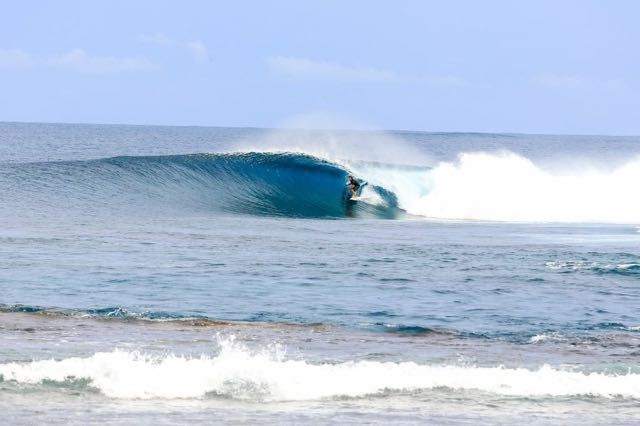
Due to the many quick visits during the rally, it was difficult to appreciate all of what the villages had to offer. There is so much more than we got a chance to see: Raja Ampat and Papua New Guinea for the diving, and the Mentawai Islands of Sumatra for the surfing.

In just three months of sailing around, we experienced orangutan feedings, river tours, incredible surf, jungle hikes, national holidays, local feasts, temple & mosque visits, drum troupes, traditional dances, elephant rides, deserted white sand beaches, and we made life long friendships. My time amongst the Indonesian peoples was truly a blessing in “5D.” From inexpensive delicacies and ethnic spices, to billions of treasured photos, there will always be a place in my heart for the beauty of Indonesia and its culture!

Variety is the one word that best describes Indonesia. From the clearest of waters to the darkest of forests, Indonesia exhibits diversity of all kinds, most noticeable in their many cultures made up of varied peoples. Through the eyes of a 16 year old who has now left Indonesia with a sad heart, my hope is that more travelers will see and experience the fullness Indonesia can offer.

Sources: Website – Wikipedia, Indonesia history; Book – Lonely Planet, Indonesia; Kandu – Traveling by sailboat through Indonesia Aug-Oct 2017.

Singapore by Trent


In just 200 years the small island of Singapore, perched at the very end of the Malaysian peninsula, has turned into a high-tech city  country with a multitude of humongous high-rises housing 5 million people. Singapore is going to be celebrating their 200th year anniversary, from 1819 to 2019, in two years.

The country of Singapore is 269 square miles. Rhode Island, the smallest state in the US, is 4 times larger with just a fifth of the population. The people in Singapore are a mix of 74% Chinese, 13% Malay, 9% Indian, and the rest are foreigners. They speak many languages Malay, Mandarin Chinese, English, and Tamil but they often speak ‘Singlish,’ a combination of Malay, Chinese, and English. Sir Stamford Raffles founded Singapore in 1819 when it was just a fishing village and turned it into what it is today. The favored Prime Minister, Lee Kuan Yew, served from 1960 to 1990 after Singapore declared independence in 1963. Religions are freely practiced in Singapore and Mahayana Buddhism is the most practiced, but they also practice Islam, Christianity, and Hinduism. During my stay in Singapore my favorite spots were the Marina Bay Sands Hotel and the adjacent Gardens By the Bay. We also visited Little India and looked in a lot of shopping malls.

Marina Bay Sands Hotel, Singapore.

Marina Bay Sands Hotel is impossible to miss. It has three 55-story hotel towers, and all three are connected by a roof terrace that looks like an enormous surfboard. The hotel has 2,561 rooms. Just across the street the Marina Bay Sands Mall has two movie theaters, an ice skating rink, and two crystal Pavilions. At the very top of the hotel they have an awesome infinity pool, one of the nicest swimming pools I’ve ever seen and certainly the highest.

Trent Rigney enjoying the high sights atop the Skypark of the Marina Bay Sands Hotel, Singapore.
Downtown Singapore view from the Marina Bay Sands Hotel….forest of highrise buildings as far as the eye could see.

We ate ‘linner’ (late lunch/early dinner) on top of the surfboard at the ‘Skypark’ restaurant, but only guests can swim in the pool. But the best part about going to the hotel is The Gardens by the Bay, a nature park, located just across the street.

Gardens by the Bay, Singapore.

The gardens are so big they’re divided into three sections: Bay South, Bay East, and Bay Central. It reminded me of Disneyland. The gardens were planted with over 250,000 rare plants, and of course the 16-story, man-made ‘supertrees’ that collect rainwater and solar power especially built for observation are impressive. Bryce and I walked on the skywalk, which is suspended between two ‘supertrees’ and has a great view of the garden and the hotel. At night they say they have a great light show.

Bryce and Trent Rigney strolling the Gardens by the Bay and Supertrees in Singapore.
Bryce and Trent Rigney enjoying the Supertree Skywalk at Gardens by the Bay, Singapore.

Singapore has tons of high fashion specialty malls. Orchard Road is a great shopping center like Rodeo Drive in LA or Union Square in SF. We only had a little time in Orchard Road, so we visited the ION Mall. The ION Mall had the most expensive things I’ve ever seen. My favorite things in the mall were the Golden Phantom speakers, best speakers in the world. It’s too bad we couldn’t see all the malls but we had a great time visiting the best ones.

Eric & Leslie Rigney at ION mall, Orchard Road, Singapore.
Interior ION shopping mall, Orchard Road, Singapore. Xmas decorations in October!
Devialet’s Gold Phantom speaker.
Trent Rigney taking a break from window shopping at Orchard Road, Singapore.
Bryce Rigney posing for Hermes and CocaCola in Singapore.
Singapore’s Orchard Road – a high end shopping district on a late Wednesday afternoon.

At the entrance to Little India are two specially made great elephants decorated with colorful plastic flowers like a Rose Parade float. Little India is a great place to find cheap food and cheap clothing. I bought my favorite shirt here. They have many Hindu Temples in Little India. ‘Sri Veeramakliamman’ is the most colorful that we saw and well crafted in Little India. We spent a lot of time in Little India. We happened to be there during Deepavali, the Hindu festival of lights celebrating good over evil. The streets and stores were festively decorated with hundreds of worshipers milling around in traditional Indian dress making their way to the temples to worship.

Deepavali decorations at the Serangoon Rd entrance to Little India, Singapore, Oct 2017.
Little India’s Deepavali elephant decoration demarking Sarangoon Road, Singapore, October 2017.
Sri Veeramakaliamman Temple with Rigneyskandu people watching during Deepavali Hindu Festival of Light Celebrations, Oct 2017.
Bryce and Trent Rigney thought Little India’s ‘celebration of lights’ decorations were impressive.

I had the best time in Singapore: hotel room, Wi-Fi, and hot showers are all things you forget are really cool until you have them again. It’s really interesting how often electric scooters are used in Singapore and they even have scooter tours which I would have loved to try.

So, over all, with so many cool places to see and things to do, I’m pretty sure I’m going to go back to Singapore in the future. Thirty-six hours just wasn’t enough time to spend in this interesting and complex city.

Before you leave Rigneyskandu.com, take a look at our new Singapore photo gallery located under ‘Recent Photos’ on the main page headers!

Vanuatu in June 2017: Living Dreams, Part III Land Diving & more

Saturday morning, a couple hours before sunrise, we pulled anchor from Ranon Bay, Ambrym, and headed north for Wali Bay on the southwestern side of Pentecost Island. By 8:30 am our anchor was set, aligned with 4 other yachts. Just as quickly as the day before, we headed to the beach. Spent phone cards broke up phone calls to the chief as he called from several different phones to guide us. We would not meet until after the diving. Plan B: Follow the crowd, and that’s what we did. The other yachties had pre-planned the land diving tour with Luke and his daughter, Aileen, the very same people Dr. Alan suggested. Again, Luke and Aileen’s faces lit aglow on the mention of Dr. Alan and Debora, reminiscing about their time spent together.

The cruisers met at the beach, ambled north toward the village of Londot where Luke met us on the way to the communal hut designate. Seated in the hut, Luke described how land diving got its start. There are various versions, but they have a common thread. A girl/young lady, to escape the unwanted advances of a male, climbed a tree, tied her ankles to something on top of the tree (the tree type and tying materials differ per version). As he approaches, she jumps and he after her. She’s saved, he falls to his death. The sport is born. Flash forward hundreds of years and here we are. A 68’ tower of sticks, tethered to a hillside, supports several dive heights. The lower diving platforms are for child beginners; the middle platforms are for teens, the highest, for the experienced adults. A male-only sport, children are free to decide whether they wish to participate or not. No shame if they do not. Jumpers apprentice under the more experienced. Injuries are said to occur only for those impure of heart and action. A successful jump lays testament to a clean and pure life. As the jumper prepares, placing himself closer and closer to the jump off point, a small crowd of topless women, older men, and young boys chant and whistle encouragement. The jumper’s ankles are tied with freshly cut vines of a particular tree, at a specific length, by those trained to select and cut the vines and tie the knots. They straighten out the vines and move away as the jumper steps forward on the end of the meter long diving board, to which the other end of the vines are tied. He takes a moment to gain his balance. The supporters’ sing louder and louder, whistling. He claps, slaps his chest, prays, and/or all of the above before finally jumping. All hold their breath collective breath as he hits the softened dirt below.

Land Dive village supporters, Pentecost, Vanuatu.
Most heralded Land Diver on Pentecost Island, Vanuatu preparing for his last dive of the year 2017!

The loud, crisp snap of his dive platform coincides with his earthly contact, absorbing some of his energy before final contact. All are pleased the jumper appears unharmed as the vines are cut from his ankles with a brisk whack of a machete. Aileen proudly points out that her 14 year-old son, Willy, is to jump. He, like the others before him, is successful. Having started with the youngest jumper, we’ve worked our way up to the highest and final jump. Not just for today, but for the entire 2017 season. He is an experienced and celebrated diver from another village. He is calm, assured, and unassuming as his nearly naked body adeptly scales the scaffolding to the highest point. His leap is graceful and successful. He’s pleased. I take my picture with him and climb the base of the tower to claim one of the cut vine ends with its soft lashings still affixed.

Eric Rigney excited to pose with the most celebrated land diver, Pentecost Island, Vanuatu.

The sailors assemble below at the seating area. Though a seating area exists, we were allowed unfettered access to photograph the event from any angle, with the caveat that women not touch the vines. Gathering together for the walk back to the seaside communal hut, we all seem slightly stunned by the shared privilege of such an extraordinary demonstration of a first people. We sailors were the only audience. Regardless of audience, land-divers jump on Saturday. They do it for themselves, for their tradition, not for tourists, not for money. The money they get from tourists ($80 per person in our case) goes to all those involved, helping encourage the young and old alike to participate, to keep the tradition alive.

At the communal hut, unbeknownst to Leslie and I, a lunch of traditional Vanuatu dishes was included, complete with a drinking coconut. To top it off, we were invited to return at 4 p.m. to share kava with the village and the jumpers. Traditionally a man-only event, the yachting women were invited to participate in the kava drinking. So we of course returned. What made the drinking even more special was the use of fresh kava made from a huge root ball harvested that afternoon. Typically kava today is served from powdered kava, soaked in water and strained. Kava, we learned, takes 10-12 years to grow before the root is ripe for drinking. Pentecost, as with many Vanuatu islands, cultivate kava for export. Bryce was allowed to participate in the kava mashing process as village chief, Peter Bebe, oversaw.

We each drank a coconut cup of kava. One was enough for me, and too much for others. Some slyly poured their undrunk kava on the ground. The boys seemed fond of it, consuming 3 cups of the mildly bitter mouth numbing solution. Kava relaxes. It’s not very intoxicating. Some suggest that were Melanesians and Polynesians to stay with kava, forgoing alcohol, they’d all be better off. That said, I heard stories of villagers drinking a lot of kava at a sitting, acting out a bit more than normal, so I don’t know . . . as always, all things in moderation.

As with the rest of our whirlwind tour, we pulled anchor early in the morning and sailed to the island just north of Pentecost where Dr. Alan described one of the world’s most beautiful bays accessible only by boat. Asanvari Bay on Maewo did not disappoint.

Asanvari Bay on the southern tip of Maewo Island is a veritable Shangri-La, complete with waterfall, beautifully tree-shaded white sand beach, rock outcrops, clear water, and excellent snorkeling. An unintended tour by a local 15 year-old gave us a quick glimpse of this isolated paradise. The village boasts 2 hyper-basic yacht clubs, small church, schoolhouse, and micro store. Wish we had had more time to meet those whom Dr. Alan had spelled out. Unfortunately, the villagers were absent, attending the funeral of a 15 year-old, who had passed away due to illness.

Asanvari Bay, Maewo, Vanuatu.

And yet again, with our three-day, three-island tour ending, we were off the next day, Monday, June 26th, with another early morning departure to arrive that same afternoon at our next stop: nearby Espiritu Santos Island, two islands away. Dr. Alan and others recommended grabbing a buoy at the Aore Resort, across the channel from Luganville, the main city on Santo and our port of departure. When we arrived, we discovered the 3-4 buoys the hotel maintained were claimed by other visiting yachts, and although we could have grabbed a neighboring property’s mooring buoy, with the day growing late, we elected to cross the channel and anchor on the lee shore in front of the Beachfront Resort, even though we had been warned that only days earlier, a boat was boarded and robbed of its electronics.

Beachfront Resort Sunset.

The resort proved very yacht friendly. Having read that Luganville had been the US’s second largest naval base after Hawaii, we were interested in getting a US history tour, as recommended by Dr. Alan. Over 500,000 troops were stationed here in the early 40’s, including James Michener, the base historian. It was from here where Michener researched what would become his “Tales of the South Pacific,” later turned into a stage musical and movie, “South Pacific.” During WWII, the US military built Luganville from uninhabited swampland; all of Luganville’s significant infrastructure comes from that period with the exception of a very new harbor presently being built by the Chinese. After the war, when leaving Luganville, US manufactures didn’t want to compete with military surplus so the government agreed not to return any of the hardware. The US offered the machinery at a very low price to the French and British who “governed” the colony. Thinking the US couldn’t possibly afford to move all that equipment elsewhere, they said “No thanks.” So US forces built a temporary jetty and drove all the equipment into the deep end of the channel, nicknamed “Million Dollar Point” after that.

Million $ Point remains from WWII military equipment.

We walked the beach and found many, many remnants. I especially liked finding Coke bottle bottoms with Oakland, CA and Seattle, WA molded into the glass. Additionally, several US ships sunk while making their way into this top-secret naval base. The largest, the USS President Coolidge, was a passenger-liner converted troop carrier. It struck two not-so-friendly US mines. All but 2 aboard survived: a fireman near the location of the mine strike, and an Army captain who, after having rescued 6 others, could not be rescued himself. Having heard the wreck was one of the best on record, Leslie endeavored to set us up with a dive with Allan Powers Diving Co. It was spectacular! The dive was simple. You walk in the sandy shallows about 50 yards before descending nearly straight down to the bow of the tilted hull below.

The dive guide showed us all around the shallowest part: the front half of the ship. A real tour guide, he uncovered or pointed out pieces of crusty warfare from hiding places: rifles, gas masks, plates and cups, and so on. Because we’d dove deeper than 100’, we had to make a couple decompression stops. It was well orchestrated and an experience of a lifetime, one of several we got to experience in less than 2 weeks.

For our last day, we rented a small car and drove up the east coast of Espirtu Santos Island. Having seen signs pointing out “Blue Hols,” we turned off the main road toward the first one we saw: Riri Blue Hol. Wow! The water was so clear and the setting so magical and playful; it was a jungle pool paradise, complete with rope swings and makeshift diving platforms. We had so much fun. And when a busload of Australian missionary teenagers arrived, for the first time in a long time, Bryce and Trent were surrounded by their own “kind.”

On the road to Port Olry, east coast of Espiritu Santo Island, Vanuatu.

The next stops where Champagne Beach in exotically beautiful Hog Harbor and Port Olry just north of it. Champagne Beach is named for is powdered-sugar fine white sand, a place ideal for a Sports Illustrated swimsuit shoot, with knotted trees overhanging the fascinating sand.

Eric and Bryce Rigney enjoying Champagne Beach’s fine sand.

With the sun ready to set, Port Olry was a quick stop, a place for the boys to run around on a sand spit that joined a small island with the larger. Port Olry, is not a developed modern port. It is a simple fishing village located at the end of a lovely paved two-lane road, a good distance away from the city ruckus.

Leslie Rigney with BnT mucking around in the background at Port Olry, Santo, Vanuatu.

The site offers beautiful beachscapes with warm friendly faces sporting fresh white smiles.On the way back, we stopped at some fruit stands to pick up some vegetables and fruits for our upcoming Darwin, Australia passage. Taking advantage of the car, we did our last minute shopping that night, provisioning Kandu for her 20-day crossing.

Vanuatu is an ancient land in a modern time. I have mixed feelings about the place. Although the people were fantastic, I sensed unease among them, possibly overshadowed by elements of international and domestic greed and corruption. A land of dugout canoes surrounded by Australian prices, a cost of living higher than that of French Polynesia, Samoa, or Fiji: it felt a bit lopsided, a recipe for future trouble. Still, it was a ‘nambawan’ dream come true: Jacques Cousteau, National Geographic’s, and Mutual of Omaha’s Wild Kingdom rolled into one. Thanks to Seven Seas Cruising Association hosts Dr. Alan and Debora, our experiences of Vanuatu will be cherished forever, or until I die, whichever comes first. Between now and then, I hope I never make a mistake that causes someone to want to eat me.

Port Olry fishing boats, Santo, Vanuatu.


Vanuatu in June 2017: Living Dreams, Part II Rom Dancing

On Sunday, June 18th, Father’s Day, after a late morning visit to the Port Resolution village on Tanna when we distributed small toys to children and Bryce and Trent played volleyball and Frisbee, we prepared Kandu for the 24-hour sail to Port Vila, Efate, weighing anchor at 2:30 p.m. The winds were strong most of the way, but shadowed by an intermediate island. We arrived, as predicted, Monday afternoon at 2:30 p.m. Customs over VHF radio said we could finalize clearing-in the next day, Tuesday, but having cleared in at Port Resolution, they would allow us to go ashore tonight.

Port Vila city front, Efate, Vanuatu.

I’m a bit embarrassed to admit it, but the boys (I just go along with it) have a habit of hitting a town up for movie theaters and McDonald’s. In Vanuatu, only the former exists, and as we soon discovered, at a very cosmopolitan price. Fortunately, they had already seen all the movies showing at the 4-plex, having previously viewed them in Fiji and Samoa for a third the price, so we didn’t partake. Local food restaurants are a challenge to find in Port Vila. Chinese, Indian, Japanese, French, Australian, Vietnamese, Philipino, pizza, hamburgers, and fried chicken; no problem. Kava was the only native thing readily available. I really got a kick sucking down my tongue-numbing kava-colada smoothie at the Nambawan Café, Kandu anchored in front.

Vanuatu suffered much devastation following the aftermath of Hurricane Pam in 2015. Typically, countries such as Australia, New Zealand, and Japan come to the aid of Southwestern Pacific islanders. In the past, they have been quite generous, but in these trying economic times, there’s a void. Never fear, China to the rescue. We’re told China began by offering Vanuatu aid in the form of tinted-windowed Buick SUV’s for the leading politicians. Then, $4M USD to remodel the president’s residence and even more to build a very large convention center, too expensive for Vanuatu to support and maintain. With the political relationships firmly established, the aid stops and the loans begin. Want a new wharf? No problem, with unemployment at a high point, China ships over hundreds of Chinese workers to build it. And don’t worry if Vanuatu can’t generate enough revenue to pay back the loan, China will just take it over, making it their wharf, their business.

Port Vila Harbor, Efate, Chinese construction.

With tourism being the main source of revenue after aid money, local Vanuatu business owners demand that the government maintain its airports, repairing the runways so that airplanes from New Zealand, Australia, and New Caledonia can again land at Vanuatu islands other than the principle one, Efate. The new president promised that within two weeks of taking office, runway repair work would commence. Two years later—nada—and the president dies unexpectedly while we were there. During all this, China continues to enlarge another wharf to accept larger cruise ships, knowing the Vanuatu government hasn’t even enough funds to repair the roads leading to and from the port. Some Vanuatuans suspect China is in reality building a future Chinese naval base, the very location used by America during WWII in Luganville on Espiritu Santo, their second largest base after Hawaii. If Vanuatu, a sovereign state, elects to allow China to have such a base, no nation can stop them. It’s a compelling argument, albeit a bit scary in terms of how Vanuatu might ultimately be impacted: its resources, its people, its environment, etc. Anyway, it’s an interesting prospect to consider, and possibly (pardon the pun) a “red flag” for all Chinese aid-funding programs.

I had wondered why Dr. Alan hadn’t recommended anything to visit in Efate. It wasn’t difficult to understand why. The people were nice, but we found the town to have a weird vibe: for instance, lots of reconstruction along the waterfront, but very few tourists, even during this, the high season. And again, the prices were too high. Bryce, on the other hand, did some research and read that the best surfing in Vanuatu was a short drive south at Pongo Village, with three excellent breaks in proximity to each other. To learn more, he went first to the modern retail store advertising Billabong, an Australian brand of surf-wear. They suggested talking to a gal at the Paris Duty-Free store. She in turn gave Bryce the mobile number of a young man, John Stevens, as someone able to assist him in his quest. We called the number and John asked Bryce to meet him at a nearby café to discuss. He also wanted to quiz Bryce as to his surfing level. Bryce and Trent went together. Twenty minutes later they returned to our café table with John in tow carting his skateboard. John explained that he and a gang of young people skate around the town and surf the southern beaches. With tomorrow being a holiday (the newly elected president just died of a stroke after only 2 years in office and his casket procession would occur that day), lots of kids would want to use the occasion to surf.

Port Vila kids learning to surf at Pongo Village, Efate, Vanuatu.

John offered to include Bryce and Trent in the casual affair: skateboard in the morning, lunch (their own dime), then surf until dark. I had initially intended for Kandu and crew to leave for a neighboring island that day, but couldn’t say no to Bryce knowing his surf days would be extremely limited (perhaps nonexistent) between here and Bali. We would instead skip Epi Island, and go directly to Ambrym Island the following day. Bryce was ecstatic, and with his wingman, Trent by his side, we trusted they’d take care of each other. The day turned out well. The boys even witnessed the President’s funeral procession. Not returning until long past sundown, Leslie had become a bit worried. She was glad her two handsome boys came home, happy, exhausted, and unscathed, not kidnapped into pretty-boy slavery. It turns out, Bryce had met the husband of the Paris Store lady in Fiji, surfing Cloudbreak. He trains junior pro surfers. Small world the international surf scene is. And one of John’s tag-along kids, an excellent surfer, is the beautiful daughter of a wealthy Vanuatu family. Is surfing replacing golf and tennis clubs as the place to meet influentials?

Port Vila Market with Leslie Rigney.

On our 4th day hanging in Port Vila, having gotten all the laundry done and gathered a few fresh fruits and vegetables, we left in the afternoon so we could arrive in Ranon cove on NW Ambrym just after daybreak on Friday, June 23rd. A relatively easy overnight sail and we were setting our anchor in black sand beneath the clearest water I’ve seen.

Kandu in Ambrym at Ranon Cove, Vanuatu.

The anchor and chain were clearly visible as if in three feet of water. We quickly dropped the dinghy with the smaller outboard and drop-down inflatable wheels. Leslie and I hastened our way the short distance to shore, rolled Wee Kandu up the beach just past the high-tide mark near some local boats, and tied its painter to a tree. As usual several older men sat along the shoreline. I asked them if they knew of a William “Willie” Adel, the contact Dr. Alan had given as the excursion point person. They indicated down the road, saying, at the end. A hundred yards later down the wheel-lined road, I asked someone working in his garden. He pointed us further down, watching as we walked, waving us across when we’d reached our destination. William greeted us from behind the simple wooden fence demarking his quaint bed and breakfast, sporting the smile and warmth of a long-time friend. So charming was he, and when I mentioned Dr. Alan and Debora, his face lit up even greater. His simple pension establishment, Ranon Bungalows (Facebook, TripAdvisor), is a set of six simple thatched-roof rooms, overlooking the beach, all traditional and made of local materials.

William Adel’s “Ranon Beach Bungalows” dining room.

After getting to know one another a bit better, he asked if, for $60 each, we’d be interested in joining a group to watch the village of Fanla dance their traditional Rom Dance and sand painting tomorrow afternoon. This day was Friday, and tomorrow we learned was the last day the land divers would jump on neighboring Pentecost Island at Wali Bay. I regretfully declined. He picked up his mobile phone and made some calls. Ten minutes later, he had arranged a private Fanla village tour, dance, and sand painting demonstration for that afternoon at 2:30, . . . no car, we’d walk. No problem, we needed the exercise. He then went about arranging our Pentecost land-diving tour for the next day, setting us up with the village chief over there. If anyone wishes to experience Ambrym and beyond, a call to William is a must (mobile +678 59 33106). Ambrym is also home of the other two active Vanuatan volcanoes.

Vanuatu is technologically simple and mostly subsistence living. Leaving the beach, villagers kindly ask us for favors. Leslie felt for one man who pointed to our dinghy rope, asking for something like that. He didn’t like the one she initially offered him, so she gave him a 60’ length of 1” braided nylon rope instead, for which he offered a volcanic stone-carved head figure for good luck.

The 40-minute walk to Fanla was not difficult but you had to be on your toes to not slip on the terrain. With each step away from the beach, the humidity level increased accordingly. Arriving at the modest village, William introduced us to Freddie, the chief and our village guide. He showed us around his village, the size of a city block, patiently answering any questions.

Freddie, Chief of Fanla Village.

He explained that they farm kava and yams on the higher hillsides during the day, housekeep in the evening, with communal kava for the men around 4 or 5pm. The village was clean and simple. The community still practices traditional ways, including the role of a chief and the rule of tabu.

Fanla Village, Ambrym, Vanuatu.

When the signal was given, we were brought to the ceremonial dance grounds, the dancers, only men, were arrayed in traditional garb. One set of dancers wore nothing but a broad black waistband holding the neck of a gourd, which covered the shaft of their penises, testicles fully visible. The other set were ornately masked in bearded wooden geometric masks, resembling the open jaws of a crocodile with rooster feathers on top; these dancers’ bodies were cloaked head to toe in hundreds of long thin dried leaves, perhaps pandanus. In their hands they held finely carved narrow war-like clubs that tapered open to shield over the hands and forearms.

Rom Dancer with mask, Ambrym, Vanuatu.

With but a few basic percussive instruments to keep time, the men performed an ancient traditional dance and chant that took me back to some past life (or TV show?). I was transported. The smile on my face could not be removed. I felt honored and grateful to have been treated so generously to this intimate cultural experience. It’s a large part of what drives me to travel in the manner that we do.

Wood statue carvings from Fanla Village, Ambrym, Vanuatu.

After a brief photo op, posing in front of the dancers, the sand painting began. Once three initial 18” parallel lines are drawn, the artist’s finger doesn’t lift from the ground. Upon completion, we were asked to guess what was depicted. They were proud to offer the meaning behind each drawing.

Two drawings later, we were shown to their handicrafts of wood, bamboo, and stone. The artists stood close behind to see what we would select. The pieces were well done and appealing. We picked out three items, a wooden mask statuette and two carved bamboo chin flutes (No, I didn’t buy a penis guard. They didn’t have my size!). We were so very appreciative of the entire experience: the hospitality, generous smiles, and learning. On a side note, we learned that cannibalism is still occasionally practiced, usually as a form of punishment, not necessarily the chief’s wish, but the village as a whole may demand it being the highest insult to punish an offending family.

As with all our departures, it’s the people that make it most memorable. Although we’d only met Willie that morning, it felt like we’d known him much longer. Leaving him was bittersweet, but leave we must if we were to see the next morning’s land diving.

Local Fanla Village artisans displaying the artwork we purchased, Ambrym, Vanuatu.
Chin Flute presentation, Ambrym, Vanuatu.

Vanuatu in June 2017: Living Dreams, Part I

Vanuatu fulfilled buried fascinations planted decades ago through American television (Growing up, I’d often watch 8 hours of black & white television daily!). From the comfort of a California living room, I viewed: people walk along active volcanic craters, naked dark-skinned men and women dancing alongside costumed figures, young men leaping high atop rickety stick towers with fresh vines tied to their ankles, hitting the ground with their heads, unfathomable tropical bays more beautiful than anything Las Vegas or Disney Resort could build, and a WWII shipwreck dive. And this is what I experienced in Vanuatu in less than 2 week’s time, thanks in large part to the advice of Seven Seas Cruising Association’s Vanuatu hosts Dr. Alan and Debra Profke.

Two months prior to arriving in Vanuatu, before even vacating our French Polynesian dock space in Marina d’Uturoa, I reached out via email to Dr. Alan, asking advice on what to see in Vanuatu in a short time. In his reply, Alan painted a step-by-step itinerary to maximize a brief Vanuatu archipelago visit. Except for the recommended port of entry, we stuck closely to his program. We intended to land in Port Vila, Vanuatu’s capital city, as previewed but winds and seas drove us further south, directly to Tanna, home of famed Mount Yasur volcano.From Fiji, a week prior to our arrival in Vanuatu, I duly filled and electronically submitted all required paperwork to Vanuatu Customs. In route to the archipelago, we reached out to Vanuatu Customs, via inReach satellite, asking if we could instead land in Tanna. Tanna’s Vanuatu Customs officer, Iau, directed us to anchor in Port Resolution on the southeast tip of Tanna. Capt. Cook named the bay after his ship more than 200 years earlier. Port Resolution is the closest harbor to Mount Yasur, but unfortunately on the opposite side of the island’s official port of entry. A $40 USD non-designated port penalty fee, plus $50 for land transportation were added to the standard $10 clearance fee. Later seeing the road conditions against which Officer Iau drove for 4 hours round-trip, it made the $50 transportation fee seem a bargain. Not having to sail a half-day against trade winds, from Lenakel to Port Resolution, made the $40 worth the penalty.

We arrived in the small bay of Port Resolution at dawn, Friday, June 16th after a 2-and-half day sail from Lautoka, Fiji. Motoring into Resolution, we were flanked by cliffs to port and starboard. The end of the bay quickly shoaled into a dark sand beach spread broadly across and in front of a lush tropical valley. A wild tropical landscape straight from the pages of National Geographic’s laid before us. A small fleet of fishermen in self-made dugout outrigger canoes paddled out toward us, casting and setting fish nets of fine monofilament. To the south, above, on the cliffside edge, a simple wooden thatched-roofed house delicately stood on stilts over-looking the magnificent bay, seemingly designed for a character out of a far-away, 19th century adventure novel. To the north, steam vented from the cliff side just above sea level, reminding us just how close we were to an active volcano, having witnessed its reddish plume against the darkness of the pre-dawn sky earlier that morning.

A few hours later, after clearing in with Customs Officer Iau, we reserved with Stanley, the Port Resolution Yacht Club representative, four places in a 4-wheel drive truck to take us to Mt. Yasur Volcano Park for the next day’s sunset excursion: $25pp R/T transportation and $100pp park entry fee. The volcano exists on private tribal lands, providing the community the right and privilege to operate an exclusive tour business, charging what they will. We soon learned that the businesses in subsistence-living Vanuatu elect to charge rates equivalent to those in Australia, while not paying staff accordingly. So restaurants, bungalows, movie theaters, and grocery stores are out of the general population’s price range. Thus we rarely saw locals frequenting these establishments. Anyway, we’d come this far, so why not spend the coin to take us the rest of the way for an experience of a lifetime, “Priceless” as the Visa commercial used to state.

‘Greeting’ formalities became quite clear and distinct after the first couple introductions. In Vanuatu, people want you to know their name and want to know yours. Instead of the generic “hello” or “how are you?,” it’s “My name is George,” followed by a look that begs, “and your name?” Then comes, “How are you?” Casual physical contact among Polynesians is rare. In French Polynesia, we say, Bonjour, Kaoha (Marquesan) or Ia orana (Tahitian); shaking their hand if it’s a guy, or a girl for the first time; and kissing both cheeks (more touching cheeks and making a kissing sound) if it’s a gal you know, or friend or relative of a friend. That’s it. In Samoa, people were very friendly, exclaiming, “Talofa,” when seeing you, even as strangers in passing. When being introduced, a handshake was less customary. It was an odd transition after two years in French Polynesia. It felt impolite not to faire la bise (pronounced, bees, meaning “kiss”). On a side note, in Fiji, “Bula” or “Bula-bula” was exclaimed at each passing or meeting. Apparently the government asked its population to greet any and all tourists with this customary Fijian “hello.” It works. You really feel your tourist presences appreciated. Fijians touch even less than Samoans. Handshakes are accepted but not expected. In Vanuatu, another Melanesian culture like Fiji, physical contact introductions were the same. Vanuatu differs in that they smile all the time, big bright beautiful cheek-bulging smiles. It’s relaxing and warm. As white people, dressed as cruising sailors, we were immediately recognized as interested tourists and treated courteously.

Chez Leah, Port Resolution, Tanna, Vanuatu.
Rigneyskandu Inside Chez Leah Restaurant, Port Resolution, Tanna, Vanuatu.

The next day, Saturday, we arrived ashore in time for our lunch reservation at Chez Leah’s, a 1-table restaurant in the village. We had three restaurants to choose from, but we liked the look of hers best. The others had more tables, but no one to speak to. Meeting Leah the afternoon before, we pre-ordered (no waste) our main courses. While Trent would have the omelet, we’d have the fresh fried mackerel. Both main courses were served on family-style platters, including separate platters of fruits and vegetables picked fresh from Leah’s garden. Even the lemon in the lemonade and the coconut cream for the vegetable sauce came from her garden. The eggs came from her hens; the mackerel, from the fishermen below fished that morning. Organic? Fresh? They don’t know any other way. From Leah speaking in French, we learned a little about village life, including utilities. Mini solar panels charge household cell phones and Bluetooth speakers. A single medium-sized household panel installed at the community store recharges portable battery-operated lights for all village households. Water comes from a hand-pump well in the center of the village—all you can carry.

Girls play volleyball; boys play soccer. Some villagers speak French as their third language, but most spoke broken English. The village dialect is spoken at home; the national language is spoken to other Ni-Vanuatuans (the Vanuatu term for native Vanuatu people). Leah’s French was so good, the island elected her to represent their craftsmen at New Caledonia’s annual Inter-Island South Pacific artisan festival. The experience changed her, made her appreciate more what she had, her lifestyle, etc. City’s are exciting, but nothing beats the simplicity of life in her beautiful part of Tanna Island. We were grateful for her generosity. Leslie gave her several gifts of basic food items and a handy sack that she appreciated. We think of Leah when we think of Vanuatu.

Leslie Rigney and Leah from Leah’s Restaurant, Port Resolution, Tanna Island, Vanuatu.

The same day later in the afternoon, the drive to Mt. Yasur Volcano Park was a learning experience. Beautiful country with people’s quick smiles, these smiles made more radiant against their dark skin. At the park entrance, I asked if there was a different price for kids. “No. Sorry.” After filling out the paperwork (there are apparently risks associated with walking on the unrailed edge of an active volcano, especially at night), they asked us to select a wooden picket sign with our country of origin written across it. “USA” having been collected by someone else, so having been recent residents of both Nuku Hiva and Uturoa, sister cities of Tahiti, we picked “Tahiti.” No one believed it, but I didn’t care. I carried the sign with all the French Polynesian pride I could muster.

RigneysKandu guys trying to stay dry and film atop Mount Yasur crater, Tanna, Vanuatu.

A brief native dance and chiefly request/acceptance ceremony later and we were loaded into pick-up beds for the ride up to the crater. A bottle of water was included. The official language of Vanuatu is an English-French pidgin. It’s so much fun to try to figure it out. Try your hand it. The water bottle label read: “Nambawan Wota, Belong Vanuatu, Gud wota, gud laef.”As we approached the pathway to the crater’s ridge, we could hear its explosions more and more impressively and feel the action of the volcano spitting up pent up gasses and red lava. We were all so very excited. We didn’t even see the pending rain cloud coming. After another warning by the guide to follow him and to not endeavor on our own paths (Bryce wanted to snowboard down it!), we headed up the steep hillside of grey ash. Having not walked more than 20 feet at a time on Kandu for the past couple weeks, this proved more labor intensive than normal, . . . oh well. Once at the edge, the guide recommended we stay to the left side, opposite the potentially deadly sulfuric gas spewing cloud, the one four others where standing in . . . so much for listening to the expensive guide wanting to spare you. As each untimed burst occurred, with particular ferocity, we could not help but be humbled by the power, the earth jumps, the heat, the (shall I say it?) shock and awe of it. The backdrop of darkness from the setting sun made the experience even more impressive, more dramatically awesome. I couldn’t wipe the smile off my cold, wet face (yes, it was cold on the windward side of the crater, not the smoky sulfuric side). I was turned into an 8-year-old boy, so grateful and exhilarated. I wasn’t going to leave until the wise guide forced me. It was worth every Disneyland Park penny of it (about the same price, after all).

Leslie & Bryce Rigney atop the Mount Yasur crater, Tanna, Vanuatu.
Mount Yasur, Tanna, Vanuatu.

On the drive from the park back to Ireupuow Village, our driver mentioned that tonight, in his village, was a talent show to support the local schools. Every few months, in different bays around the island, youth groups lead by adults gather to perform in an ad hoc talent auction, the proceeds of which benefit each group’s respective school. Tonight’s talent show auction happened to be in his village, the bay where we had anchored Kandu the day before. How could we miss this? The event was held in the covered community center, a medium-sized cement-block hall with newly mounted tin roof following 2015’s Hurricane Pam. We tried to view the spectacle from outside, but those inside soon covered the windows. No freebies. The local kid standing outside next to me said, 50 vatu per person ($0.50). So we went around back to pay our entrance fee: 200 vatu per person (tourist price, perhaps?). Oh, well, it’s for a good cause. Sitting on the floor in the midst of the villagers was magical, transformative. The young lady next to me explained what we were witnessing. The performers sing and/or dance. A member of the audience will pay the kitty to remove a particular performer from the stage, vanquishing them from performing. Less than a minute later, another member pays more to have that person returned to dance again. It’s all in good fun, no hard feelings. Mothers were pulling their sons off while their sisters or aunties paid to have them renewed. After about 10-12 minutes, the emcee cuts the music, and then starts the process of auctioning the price to have them start again. When he got to 1000 vatu ($10 USD), I handed the vatu currency note to Bryce and insisted he be the one to brave the crowd and pay the ransom. The emcee was surprised to see a young tourist come to him. He asked Bryce what he wanted for the money. Bryce said, for them to dance again. This impressed the villagers. “Dis is a gud ting,” smiled the young lady next to me. And the dancing renewed. We LOVED it! Almost 9:30 p.m., understanding the event would run past midnight and not having the habit of staying up much past 8:30, . . . and having to dinghy back to Kandu, we decided to call it quits and left between two acts, all eyes on us. It felt odd to be ogled as foreign objects, but so it is.

Eric Rigney on Tanna Island, Port Resolution, Vanuatu.

Samoa Days by Trent Rigney

South Eastern Coastline of Upolu, Samoa

Samoa was a great place to visit. We visited Apia, capital city on the island of Upolu, the smaller of the two islands. The other island is called Savai’i, a bit like Hawai’i. Samoa used to be called Western Samoa to be different from ‘American Samoa.’ ‘American Samoa’ is an American overseas territory. The people of Samoa voted their country name to be simply ‘Samoa’ when it became it’s own country, independent, no longer a protectorate of New Zealand. In Apia, they have great restaurants and really nice people. The food in Samoa is much cheaper than in Tahiti and the people were always smiling. Not much Wi-Fi in Samoa but they have great surf and exciting new things to do.

There are all kinds of special natural wonders on Upolu all owned by different villages. In order to visit these sites, instead of paying a national park fee, you pay the family or village who owns and maintains the site. We got to visit the Papase’ea Sliding Rocks, the To Sua Ocean Trench, and the Piula Cave Pool.

The Papase’ea Sliding Rocks was mind blowing. We asked locals how to get down to the slides just to make sure we wouldn’t get hurt. There were over a hundred well-maintained stairs to walk down. It was a hot day, so there were already a lot of people visiting the falls and slides. Dad asked a local how to slide down the rock. He went first, then I went, Bryce and mom last. It took some time for her to gather her courage. After awhile having slid a lot, Bryce and I went over to the waterfall. I went under and it felt like I was getting a massage. It was the best natural rock slide I’ve ever slid on. We all had a lot of fun.

To Sua Ocean Trench, Upolu, Samoa

The To Sua Trench was nothing I’ve ever seen before. When I saw it, it looked like a big blue hole in the ground. The sides were covered in vines and plants. It was located next to the ocean with what looked like pretty good surf swell. To get down into the water hole, we walked down some stairs then climbed down a ladder made out of huge trees. You can jump off the ladder at whatever height you want (no rules) then swim into the connecting cave. It was lightly raining, not cold though. Bryce and I jumped and swam to our hearts content in the refreshing fresh water.

View from the cliffside next to To Sua Ocean Trench. Could have been good surf!

Another day we got to swim again in cold, fresh water at Piula Cave Pool located on the north side of the island, also right next to the ocean. When you go deep in the cave where it’s dark, your body turns blue. It might turn blue because the water was super clean, or because the rock ceiling dripped water minerals in the water. It sparkled in the sun. There were two caves and we heard they were connected by a small opening that you could swim through, but the passage was dark and under the water so you would’ve had to hold your breath all the way to the other side. We didn’t have a light and a mask, so we didn’t go.

Piula Cave Pools, Upolu, Samoa

We had a great day visiting ‘The Samoan Cultural Center’ to learn about different aspects of Samoan culture. First, a trio of men danced a Samoan paddle dance.

It was much tamer than Marquesian and Tahitian dancing. It wasn’t a war dance as the three men dancing were all smiling. A woman danced too, but all she seemed to move were her arms, hardly any hip and leg movement.

After the dance, the performers treated us to a kava ceremony and explained, back when they were cannibals, if they didn’t give you a kava ceremony they would eat you. Next up, we walked to see real tattooing in progress. Samoan artists like using their old wooden tools, but in an upgraded style. They used to attach shark teeth on a stick, but now they use stainless steel combs. We got to see them tattooing on two Samoan men. It looked very painful. Every Samoan guy has the same tattoo in the same spot. For Samoan men, it’s their dream to get this tattoo, but if you start and then stop because it’s too painful, you disgrace your family. The session goes for an hour a day for six days.

Lastly, we went to see how you could make clothing and artwork from bark. You cut off a branch from a specific tree, and carefully remove the bark. Then they separate the outside of the bark from the inside layer. After, you get two shells, one that is a little sharp and one that isn’t. After you’re done scrapping the bark, it’s six times the size. They stretch it out with rock as weights and let it dry. They dry it in shade letting the wind and air dry it because the sun dries it too fast.

Samoa has some great surf, but you have to pay to surf. Families own surf sites, which I don’t think is right. You can’t own a part of an ocean! Samoa is a Christian place so you can’t surf on Sundays. There are some surf resorts in Samoa and they pay to get permission from the families to go surfing, but they can only allow 12 people to surf at a time. We went to a resort and made an arrangement to surf on the following Monday morning. The spot was an hour and ½ away from our boat, and we wanted to catch the first boat out leaving early from shore at 6:30 am. So we woke up at 4:30 to drive over to the other side of the island and the surfer guide said we couldn’t go surfing with them. He said it in a really mean and aggressive way. We left and searched for another way to paddle out to the surf later that same day. When we arrived, that surf guide was frustrated we were there.

Internet photo of Salani reef

It’s said that Samoa and Tonga are where all the Polynesians came from and that the islands form a triangle in the Pacific from New Zealand in the west, to Hawaii to the north and Easter Island at the eastern corner and all the French Polynesia islands are in the triangle. Rapa Nui is the island where the performers wear the least amount of clothing when they dance. Performers in French Polynesia and Hawaii wear similar clothing, using grass and leaves, coconut shells and pareos. In New Zealand, dancers wear warmer outfits sometimes with fake animals skins. It’s cold in New Zealand even in summer.I loved the rockslide and the trench. Bryce and I had a great day surfing the Salani reef. I loved how Samoa, being next to ‘America Samoa,’ had my favorite chips that we’ve not found anywhere else: Spicy Hot Cheetos. We were going to tour Savai’i but immigration would only let us check out from Apia and dad didn’t want to sail back against the wind. After just one week only, we left to Fiji.

Daily Log Notes: Suva, Fiji by Leslie

Suva Harbor, Fiji

6-3-2017 9:00 pm

We pulled-up anchor to depart Suva, the capital of Fiji, late this afternoon at sunset around 5:30 pm. Eric estimates our arrival at Musket Cove Marina (surf extraordinaire!) around 2:00 pm tomorrow. The sky was gently crying in anticipation of our departure. The guys did a bang-up job getting the topside ready in the wetness. There was much to do: rinse the small outboard with fresh water, hoist ‘Wee Kandu,’ our dinghy, up on deck, tie it down, move our larger 10 horse outboard engine to the aft stanchion fitting (it was straining the mast pulpit where it sat previously), set-up the lines to sail and prep the cockpit. Bryce and Trent’s hands and minds are remembering what to do without having to be directed. It’s terrific that I don’t have to prep both topside and down below too. Always when living aboard, things are pulled-out to use and then not put back in their designated places. The laundry hadn’t yet been stowed; groceries needed to be organized and dishes required washing and stowage. It’s quite the preparation. But if everyone does his or her part, it can be relatively quick.

Due to our latest experiences departing into rolling seas, we all swallowed anti-nausea, seasickness medicine earlier in the day around lunchtime. We are all benefiting immensely from having taken the precaution.

9:30 pm – Ohh – the rain and wind have picked-up. It’s a soggy night, but had we waited, the weather & conditions were only going to worsen. Happily, our hard dodger is providing more than sufficient shelter to hide behind out of the wind and most of the wetness. I’m not wearing a raincoat as it’s not cold, although my bottom is soaked through. On nights like this, along with our doubly equipped lifejacket/harness, we wear a tether line attached to a solidly anchored cockpit ring. After two and ½ years of use, our poor lifejackets have unfortunately developed spots of black mold. I cleaned them well before leaving Raiatea with soap, water, vinegar and anti-mold spray to no avail. Evidently, I wasn’t able to eliminate all the mold spores that insist on living. The jackets look quite nasty and smell worse. I’ll have to try and clean them again. Ugh! At US$250 a pop, they are worth not replacing. Plenty of other things to spend our money on.

Friendly supermarket employees.

With time to reflect, I think back on our recent experience. Suva is a small city bursting with energy. There are taxis galore with friendly drivers. All the people we met, Fijian and East Indian, were cordial and helpful. “Bula-bula.” I felt welcome. Eric had heard that the population was instructed to be friendly and helpful to tourists to encourage tourism. Well, their outward enthusiasm affected all of us positively. Someday, if the opportunity were to arise, I would love to visit again.

Bryce Rigney at the entrance of Village 6 Cinemas in Suva, Fiji.

The city of Suva is the most attractive city we’ve seen out of all the islands we’ve visited so far, perhaps because its movie theatre was modern and clean….lol. Like in Samoa, we were so starved for a modern film experience that we attended movies every evening since there was nothing else going on and the ticket price was a mere $4.00 USD per person. We enjoyed seeing great Bollywood films along with international box office hits: Wonder Woman, Pirates of the Caribbean, and the very silly Bay Watch. Bollywood theatergoers seemed especially amused by our presence, almost giggling as our family entered the cinema chamber and found our seat assignments, as if they thought we were lost, surprised even more so that we returned after the obligatory Bollywood intermission. We thoroughly enjoyed Suva’s East Indian cultural influence in clothing, work ethic, and on the delicious food flavored with Indian spices, although it’s typically quite salty.

Suva was also one of the most plentiful and resourceful of cities we’ve visited. Eric was even able to replace our shattered cockpit dodger window with Safety E glass, matching what was lost. Just as with the rest of Fiji, the glass cutting was immediate and inexpensive. One USD equals two Fijian.

Taro galore!

The outdoor vegetable market offered a large selection of beautiful and proudly displayed seasonal foods: pineapples and mandarin oranges were the most plentiful and succulent. Unfortunately, their grapefruits were dry and terrible: nothing like Polynesia’s succulent ‘pomplemouse.’ Lots of okra, huge yam roots, taro, cucumbers, papaya, eggs, cabbage, bok choi, green beans, carrots, celery, and delicious drinking coconuts were for sale. The fishermen offered a variety of small and large fish, green crabs of all sizes, sea grass, sea grapes, clams and lobsters. It was a cornucopia of plenty. With so many choices of fresh foods to eat, the population looked healthy and fit with bright, naturally straight teeth.

Salty sea grapes traditionally served with grated coconut.

Yesterday, on our last day, Bryce and I stocked up on the many fresh selections at the market plus stopped in a local store to pick-up bread and boxed milk. Thank goodness I had a helper to help carry the many shopping bags. Feeling it would not be convenient to walk our folding aluminum cart into the city center, we instead hired a taxi from and to the Royal Suva Yacht Club where our dinghy was docked. It was a five-minute dinghy ride to Kandu, anchored with other sailboats in the murky bay. Our 10hp outboard having developed a problem with its propeller the night before, we were relegated to use our slower and noisier 3hp. At least it was downwind.

Rigneyskandu posing outside the National Fijian Chief Hall where chieftains meet to discuss local policies.

And finally, Suva is where Eric, before leaving Raiatea, found that the US Embassy would be willing to allow a commercial courier to ship our boys’ renewed passports to his brother in Sydney. Samoa would not, and no other location would be as convenient as Fiji or Samoa. Suva’s newly constructed US Embassy was pristine and heavily guarded. The guards at the guard station joked with Trent that they’d play on his DS while he was inside. Leaving, Eric joked, “Even the fountain water tastes American!”

Daily Logs: Maupiha’a and Mr. Toad

Daily Log Notes & Observations by Leslie Rigney

Mipaha’a lagoon

Wednesday, May 10, 2017 – Back on the blue. We had an exceptional time in Maupiha’a (Mopelia). The dinner we shared with Norma and Harris was absolutely delicious. It started out with a home-brewed aperitif made from leavening, water and lychee fruit, aged over three months. Incredibly tasty! We should have gotten the recipe! We then enjoyed a coconut palm heart salad, seasoned rice with home grown green beans and as much lobster and coconut crab as we could eat, perfectly cooked and seasoned. The coconut crab was my favorite as I had never seen or experienced it before. Then dessert was a delicious fruit salad of papaya, banana, and coconut shavings served with chocolate cake that we brought.

Coconut crab served for dinner.

The boys opted out of the cake if you can believe it, because they had previously set-up their tent and bedding for a campout on coconut crab motu. With the setting sun, they needed to zoom away before they could no longer see the coral obstacles! We didn’t hear from them again until morning, but we worried terribly, as a nasty storm blew in just after Eric and I returned back to the boat after dinner, rocking the boat violently all night long.

Here is Bryce’s recount of that crazy night: “Trent and I set-up our tent and bedding while there was plenty of sun before dinner. We returned to the crab-inhabited motu after dinner at sundown with the dinghy. We made sure to tie securely the dinghy to a tree in order not to lose it or we would have in BIG trouble. From the beach, we walked back to the tent on our way collecting firewood as there were dead trees everywhere. I used the skills that I had learned while camping with friends in Raiatea: how to collect palm fronds and turn them into bundles of fire starting material. With dry leaves collected from under a big tree and piled over rocks made into a hill, unlike in survivor, I started the fire with a bic. Then we added sticks and palm fronds over that. Once ignited, it burned hot. I turned on my little boombox to calm our nerves about the possible invasion of crabs that we had been warned about during dinner…we were a tad bit nervous. We looked for more firewood to last the night and prayed that it wouldn’t rain. As Trent was collecting firewood, I heard, “Oh my God!” coming from Trent’s direction. “Bryce, Bryce, LOOK, there’s one of those crabs!” The body was the size of a man’s hand lengthwise. It was dark blue in color – they only turn red when they’re cooked. The legs made it look enormous. So I grabbed my machete and forcibly pushed it away as a warning so it wouldn’t come nearer to our camp. The crab was not aggressive, just curious. He quickly scuttled away. We saw three of them in total, but after we scared the first one away, the others didn’t approach. I think we were camped close to the first crab’s nest. It became very dark, so we scrambled inside the tent to play cribbage. We started to fall asleep, when we heard sprinkling rain. Trent said, “Gee, I hope our tent is waterproof!?!” Then it started to rain harder. We felt a couple drips, but thought, “Oh, we’ll be fine.” A little later, we spread out our feet and felt water. Water had started to pour into the side of our tent. Thank goodness Mom had the idea to bring mats to sleep on. As it was we were getting soaked. Then the wind picked up and it started to rain harder. The top of our tent, even covered with a fly, dripped constantly. At about 2 in the morning, we thought about going back since the rain had stopped, but then it started raining in force again. We slept poorly, wet and cold, huddled together soaked on our somewhat dry mats. Of course, our fire was drenched. Up at sunrise, we quickly packed-up and returned to Kandu. Mom and Dad were relieved to see us and the dinghy in tact! Evidently they had worried about us all night long.”

The next morning, due to not getting quality sleep, the boys slept on the boat while Norma and Harris took Eric and me on a ride in their four wheeler to the other end of the atoll. The men rode in the front cab while Norma and I enjoyed a pleasant outdoor air ride in the back lounging on a wooden loveseat. At the end of the driveable atoll, we met a couple that hailed from a family that had lived on the atoll the longest. Along with harvesting copra, they raised pigs. Their living quarters were simple, yet tidy. The 4 pigs were all females and babies; the males had already been harvested. Fresh off the tree drinking coconuts were offered all around…what incredible hospitality.

Norma, Harris and their lovely friends.

Making our back to chez Norma and Harris, Harris stopped off to determine a good small palm tree to harvest for eating. It was amazing how he chopped down and then stripped the outer bark to expose the soft inner whites of the interior…palm heart. The palm heart Harris offered us was enormous, the size of a T-Rex bone. It tasted sweet with a delicate flavor of coconut, bien sur!


5/10/2017 10 pm

Leaving Maupiha’a lagoon in the late morning, we were on our way to Apia, Samoa. It’s a solid portside broad reach – our main sail, fluorescent orange staysail, and genoa are flying. The two larger sails, main and genoa, are reefed to maximize power but minimize heeling over, thus increasing our balance. Due to the large swell, it’s a ‘Mr. Toad’s Wild Ride.’ Trent was nervous to perform the first watch, but armed with his new book, he faired well. No rain, but nevertheless wet due to ocean spray into the windward side cockpit. All hatches and port-lights are locked down tight. The swell is large and pushes us over regularly. Everything is rattling.

5/11/2017 6:00 am. Exhausted, Bryce woke me early. Rough night. Eric was up a several times. The wind got stronger during the night. They had to furl in the genoa.

5/11/2017 11:30 pm. Not much has changed. Still wild though I dared to make pancakes this morning and pasta spaghetti for dinner….no easy feat when the pots want to come tumbling off the already gimbling stove. Had a few spills making the sauce. Bryce made Capuccino this morning and spilled the entire quantity. In reaction, he threw a spoon. When I spill something due to an aggressive wave, the expletives are many!

Water water everywhere, not a drop to drink!

Tupa Mascot of Raiatea

Skateboard park mural art in downtown Uturoa, Raiatea honoring the Tupa crab.

In Raiatea, the tupa (land crab) is the island mascot. Its image is featured on all the local island and city insignia. Whenever you walk along the waterfront road, these little crabs scramble for cover, hoping to avoid being someone’s dinner. In fact, the edible tupa are revered for their prolific nature, quick to reproduce and prepare for dinner. During years of island famine, tupa provided necessary sustenance for its otherwise starving people.

2017 mural painted on a city hall wall during the graffiti Intl art festival, Uturoa.
Located at a turnaround in the middle of the town Uturoa welcoming drivers to town.
City and island map in downtown Uturoa, Raiatea. Note the crab insignia in the upper left corner.

VIDEO: Tupa crab on the move!

We were invited to a fundraising event on the southwest side of Raiatea. Among the typical Polynesian fare of roasted breadfruit, pulled pork, coconut milk taro and banana poi, they offered the below delicacy. The inside was like a cream soup a la tuna flavor. It really was quite delicious.

Tupa crab bodies cooked and served at a huge fundraising event. Delicious!

These little crabs are harmless and sorta charming. After being in Raiatea for some time, they grow on you. Thus inspired, I drew my own reminder of these silly land crawlers that show enormous bravery under stress when caught outside their dugout holes.

Zentangle drawing by Leslie Rigney

Island Without Shade: Rapa Nui

Moai of Easter Island at the Hanga Roa, Tahai site. The distant moai is the only one on the island that sports eyes!

Easter Island is a tiny speck of land in the South Pacific, created by a series of massive volcanic eruptions that transpired under water. Easter Island is basically a big mass of dried lava located 27.1130° S, 109.3496° W covering up only a small space of 64 sqare miles. The island is home to 5,761 people (updated in 2012). The island is 1,289 miles from the nearest land, Pitcairn having only 50 residents. Easter Island is one of the most remote islands in the world, yet the island is well known today and has four commonly used names: the English version, “Easter Island,” the Polynesian name, “Rapa Nui,” its European/French rendition, “Île de Pâques,” and finally its Spanish title, “Isla de Pascua.” Easter Island boasts 70 volcanic cones and three principal craters. Terevaka is the tallest crater on the island at 11,674 feet tall. Rano Kau whose crater can be seen from space, and Rano Raraku are the other two volcanoes that help make the triangular shape of Easter Island.

Satellite view of Rapa Nui. Rano Kau crater is located at the southwestern point. Rano Raraku is located west of the northeastern point boasting a small lake.

The island that became ‘the island without shade’ was found around 800 CE when the first Polynesians arrived in their canoes. Seven centuries later, the island population grew to an estimated 15,000. Around the 11th century started a rampage of moai rock statue carving through the 17th century. These moais were 20-ton volcanic ash rock carvings erected to praise loved ones that had passed away: primarily chiefs and gods. With the erecting of these moais came the deforestation of the Island. How do we know there were trees? In 2006 a group of scientists arrived on Easter Island to examine and take samples in the crater lakes. The samples provided proof that the island was previously heavily forested, with a giant percentage of the trees being palm.

Bryce Rigney having ridden horseback to the highest point on the island, Terevaka, looking back on Hanga Roa…no trees!

Theories for the deforestation prompted the question: Where are the trees? One of the most believed theories for the deforestation of Easter Island was the chopping of trees for moving the giant moai statues. Each time the carvers went to move the 20-ton carvings they would chop down trees to roll and lower the moai’s into their designated areas. Under the increasing weight of the moai the tree logs would shatter and crush quicker, demanding more trees to be cut down. As the competition to build the biggest and best moais expanded, the population of trees diminished but the moai building didn’t stop. Not only was the carving of Moai involved in the destroying of trees, but another theory involved the huge rat/rodent population. Purposefully brought along by the Polynesians as a source of food, the wild rats dug down under the trees and crops to eat the roots, eventually killing the tree or crop. The rats also consumed any new palm growth, so there were no new growth trees.

Anakena Beach. These moai are the best preserved because they were buried in the sand for a couple centuries.

The third theory used mostly by the local islanders is a combination of drought and fire. With the help of a few Chilean scientists they were able to figure out that sometime during the time of the moai building and the rat explosion, there was a huge drought. This drought continued for more than five years and likely contributed to a huge fire, which raged through the remaining forests. So with the drought, the starving rats, the needy humans (wood and bark were used for fuel, tapa clothing, building houses and boats, wood statues, etc.), and the demanding giant moai statues, all the island’s trees completely disappeared. This left the aboriginal people trapped with nothing but the possibility of war to fight over the remaining resources (fishing grounds, water access and some agriculture) and cannibalism.

Dangerous cannibals….huh? No, Tapati dancers!

Without trees and solid crops, a peak population of 15,000 indigenous islanders started to diminish. The first noted contact with Europeans was when Jacob Roggeveen, a Dutch explorer who came upon the uncharted island on Easter Sunday, 1722, with several ships looking for Terra Australis. Their week-long anchor (only one day on land) hoping to obtain water and supplies of which there was little, undoubtedly impacted the islanders who suffered 12 dead from musket shots during a skirmish and later sickness due to close contact with diseased sailors. Likely because of the islands insignificance in natural resources, the next visitors didn’t come until 1770: a Spanish expedition from Peru arriving to claim the island for Spain. Not having forgotten the Dutch, the trapped islanders (no more trees to build boats) and clan chiefs cooperated by signing a written contract acceding to Spain. (The islanders had likely never seen written language before – it is speculated that seeing written language provided the inspiration for their own written language on wooden tablets: Rongo Rongo.) At this time, the Spanish reported finding the proud moai statues standing upright. After six days the fleet departed with a 21-cannon salute! Imagine the impression the sound made on a trapped population left to contend with disease caused by the sailors.

Representation of a Rongo Rongo tablet.

Incidentally, the Spanish never came again, but four years later, Captain James Cook, he and his crew very sick, arrived hoping to replenish the ship’s water and food supplies. “The British found the island to be in a noticeably worse condition than the Spanish had reported four years earlier, and it is likely that there had been heavy fighting on the island during that short period. Statues had been toppled, the islanders were in extremely poor health, and such were the lack of available supplies, that Cook set sail four days later;” Grant-Peterkin. Due to starvation, unrest and disease introduced by sailors, it seems that riots between clans escalated where moais were torn down (the last moai reported standing was in 1836). Cannibalism erupted; people started eating one another to survive. A brutal warrior, ‘might makes right’ type society developed, one of complete anarchy. At some point the population dropped to a low number of around 750 people.

Birdman stone slab paintings.

It is suggested as early as the end of the 1600’s and beginning of the 1700’s due to lack of resources and unrest well before the first Europeans, the beginnings of the Birdman competition/religion were underway. In the later part of the 1700’s and over the turn of the century into 1800, the savior of the few survivors was the adoption of the new Bird Man religion idealizing bird’s eggs and worshipping the God: Make Make. Each clan would choose a single man to represent them to compete for leadership of the year. The annual race was a 300-yard climb from the top of the vertical drop of volcano Rano Kau ridge to the bottom. Then it was a 3-kilometer swim to the furthest islet, Motu Nui (the breeding ground for the sooty tern bird).

The three little motus just off Orongo Village. The sooty terns inhabited the furthest, Motu nui.

From there the candidates would grab the first egg from one of the bird nests, swim and climb back up the ridge, struggling not to break the egg. The candidate who succeeded either designated the pre-selected leader of his clan as Birdman or became the next Birdman himself.On the ridge of the Rano Kau volcano at the Orongo Historial Village site, the houses built for competitors and supporters have been completely reconstructed. The houses are all made of giant slate slabs layered up to a height of about 6 or 7 feet. To be up there was really a great sight. My favorite was being able to see the three islets in the distance knowing that at one point on Rapa Nui the brave representatives swam across to capture an egg. During this period, the population grew back to about 3000 inhabitants. However, the Birdman religions’ demise was prompted by the Peruvian’s need for cheep labor. In 1862, the population regrowth of Rapa Nui was uprooted during a series of raids where up to 1,500 of the strongest and most knowledgeable (including clan chiefs and medicine men) were taken to work as slaves in Peruvian agriculture and mines. At some point, only 15 of those were returned to the island due to illness, once again introducing more disease: syphilis, smallpox, leprosy, etc.). The last recorded Bird Man race was in 1866. In 1867 the Catholic missionaries abolished the Birdman practices. Ten years later, in an 1877 census, the island population reported a low number of 111 people.

Birdman petroglyphs at Orongo Village.
Trent Rigney, Eric Rigney and Bryce Rigney all smiles near a faux Rapa Nui petroglyph just outside Orongo village..
Ahu Tongariki at Sunrise, Rapa Nui on February 2, 2017.

In 800 CE a group of about 700 Polynesians landed on a heavily forested island with palm trees, edible plants, and tons of seabirds and fish. Nine centuries later the same island was completely deforested, and covered with 1,032 carved moais. In May 1960 a Chilean earthquake measuring 9.5 hit and brought a series of three 70-foot waves that scoured the south side of the island destroying abandoned slate houses, jostling around the previously toppled moai statues and generally wreaking havoc with leftover Rapa Nui artifacts. After the tsunami the island was a seemingly un-repairable wreck. But with the help and interest of archeologists like Thor Heyerdahl, Japanese businessmen, the Chilean government, and ambitious locals, the island and its culture were pieced back together starting in the late 1950’s eventually making it the very popular tourist attraction it is today!

Bibliography:

Books

Frommer’s 500 Places to Take Your Kids Before They Grow Up, 1st Edition, Hughes, Holly. 2006. Published by: Wiley Publishing, Inc. New Jersey USA.

  • Easter Island, Fieldstone, Sarah. Tazkai LLC,
  • Child of the Sea, Cornell, Dorna. 2012, Cornell Sailings, LTD, UK.
  • A Companion To Easter Island (Guide to Rapa Nui), Grant-Peterkin, James.

Website

  • mysteriousplaces.com Explore Sacred Sites & Ancient Civilizations Explore Easter Island September, 14 2016, By: Jan
    Thor Heyerdahl (top right wearing all blue) excavation of an abandoned moai at the Rano Raraku quarry.

    by Bryce Rigney with Leslie Rigney